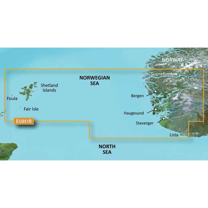
Garmin BlueChart G3 Regular Area - HXEU051R Lista-Sognefjorden
Estimated Delivery 7 - 14 days
BlueChart g3 coastal charts provide industry-leading coverage, clarity and detail with integrated Garmin and Navionics data. Also included is Auto Guidance technology, which uses your desired depth and overhead clearance to calculate routes and provide a suggested path to follow — overlaid onto your chart. NOAA raster cartography is also available as a free downloadable feature via the ActiveCaptain app. It gives your chartplotter paper chartlike views of NOAA-surveyed areas in which individual points of interest are labelled with corresponding longitude and latitude information. Worldwide coverage is available by regions as accessory cards or via download; each region is sold separately.
Compatable with ECHOMAP™ Plus series chartplotters.
Unparalleled Coastal Chart Coverage
- Provides industry-leading coverage clarity and detail with updated coastal charts that feature integrated Garmin and Navionics data
- Auto Guidance1 technology calculates a route using your desired depth and overhead clearance and provides a suggested path to follow
- Includes Depth Range Shading for up to 10 depth ranges enabling you to view your target depth at a glance
- Up to 1-foot contours provide a more accurate depiction of the bottom structure for improved fishing charts and navigation in swamps canals and marinas
Auto Guidance technology
The Auto Guidance feature calculates a suggested route using your desired depth and overhead clearance.
Depth Range Shading
This feature displays high-resolution Depth Range Shading for up to 10 depth ranges so you can view your designated target depth.
Detailed Contours
BlueChart g3 charts feature 1-foot contours that provide a more accurate depiction of bottom structure for improved fishing charts and enhanced detail in swamps canals and port plans.
Shallow Water Shading
To aid in navigation Shallow Water Shading allows map shading at a user-defined depth to give a clear picture of shallow waters to avoid.
Compatable with ECHOMAP Plus series chartplotters.
-
 Garmin BlueChart G3 Vision Regular Area - VEU014R Italy Adriatic Sea
MPN: 010-C0772-00£280.00 £233.33 -
-
-
-
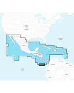
 C-Map® Atlantic Coast,Gom & Caribbean Contl-4D£248.34 £206.95
 -
-
-
-
-

-
-
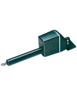
 Quick BTQ 185-95 Single Prop Thruster - 95KGF 24V No Casing
MPN: FGBT18095240T00£3,725.75 £3,104.79