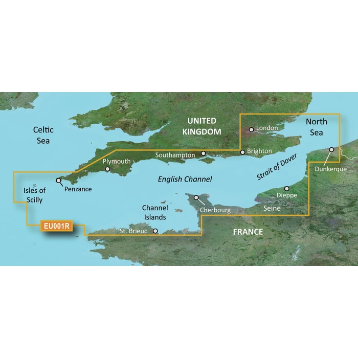
Garmin BlueChart G3 Vision Regular Area - VEU001R English Channel
Estimated Delivery 7 - 14 days
RRP £259.99
Experience unparalleled coverage and brilliant detail when you're on the water. BlueChart G3 Vision coastal charts provide industry-leading coverage, clarity and detail with integrated Garmin and Navionics content.
Compatable with the Garmin GPSMAP and ECHOMAP series Chartplotters.
Garmin BlueChart G3 Vision
Premier coastal charts
- Industry-leading coverage, clarity and detail with new charts that feature integrated Garmin and Navionics content
- Auto Guidance1 quickly calculates a suggested route by using your desired depth and overhead clearance
- Includes Depth Range Shading for up to 10 depth ranges, enabling you to view your target depth at a glance
- Up to 30 cm (1 ft) contours provide a more accurate depiction of the bottom structure for improved fishing charts
- To give a clear picture of shallow waters to avoid, the Shallow Water Shading feature allows for shading at a user-defined depth
- Experience unparalleled coverage and brilliant detail when you're on the water. BlueChart G3 Vision coastal charts provide industry-leading coverage, clarity and detail with integrated Garmin and Navionics content.
Auto Guidance
Whether you are fishing or cruising, select a spot, and get a route showing you the general path and nearby obstructions at a safe depth.
Depth Range Shading
This feature displays high-resolution Depth Range Shading for up to 10 depth ranges, so you can view your designated target depth.
Shallow Water Shading
To give a clear picture of shallow waters to avoid, this feature allows for shading at a user-defined depth.
Detailed Contours
BlueChart G3 charts feature 30 cm (1 ft) contours that provide a more accurate depiction of bottom structure for improved fishing charts and enhanced detail in swamps, canals and port plans.
High-resolution satellite imagery
High-resolution satellite imagery with navigational charts overlaid gives you a realistic view of your surroundings. It's our most realistic charting display in a chartplotter — ideal for entering unfamiliar harbors or ports.
FishEye view
This underwater perspective shows 3D representation of bottom and contours as seen from below the waterline. Interface with sonar data for a customised view.
MarinerEye view
This view provides a 3D representation of the surrounding area both above and below the waterline.
Aerial photography
Crystal-clear aerial photography shows exceptional detail of many ports, harbours and marinas and is ideal when entering unfamiliar ports.
Compatable with the Garmin GPSMAP and ECHOMAP series Chartplotters.
-
 Navico Simnet Cab 0.3 M (1 FT)£40.89 £34.07
 -
 Quick BTQ 185-105 Twin Prop Thruster - 105KGF 24V No Casing£4,038.98 £3,365.82
 -
 BEP Millennium DC Branch Circuit Breaker Panel - 28 Circuits£1,625.65 £1,354.71
 -
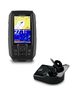 Garmin STRIKER Plus 4 Fishfinder & Dual Beam Transducer£154.00 £128.33
 -
 ICOM Extension Cable for RC M600 10M£78.00 £65.00
 -
 C-Map® Atlantic Coast,Gom & Caribbean Contl-4D£248.34 £206.95
 -
 Octopus Drives Adapter Plate Kit - Gen I BP Valve£94.80 £79.00
 -
 Fusion Apollo Speaker Grilles (pair) - 7.7" Sports Grey£59.99 £49.99
 -
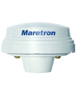 Maretron GPS Antenna Receiver£291.70 £243.08
 -
 Raymarine Cyclone Radar Power Cable - 15m£217.67 £181.39
 -
 C-Map® Discover - Mediterranean South Central£134.38 £111.98

