Garmin Navionics+ Chart: EU075R - Ireland, West Coast
Ready to dispatch
RRP £149.99
Coastal coverage of the north and western coasts of Ireland from Cork to Belfast including the entire Shannon Inland and Shannon-Erne Waterways, Galway Bay and Lough Neagh. Also included is the southwestern Scottish coast from Colonsay to Campbelltown. Supplied on a SD-Card (Micro SD With SD-Card Adapter).
- Navigate with our best offshore and inland lake coverage for your Garmin chartplotter
- See it your way. Customise your view with various chart layers and overlay combinations
- With your included one-year subscription, access daily updates via the ActiveCaptain smart device app
- Auto Guidance+ technology lets you navigate with suggested dock-to-dock routings
- Select up to 10 colour-shaded target depth ranges to scope out the best fishing spots
It's A Whole New Look On Your Chartplotter
Featuring vibrant colours, a streamlined interface and combined coastal/inland content with a popular Navionics style colour palette, Garmin Navionics+ cartography makes it easy to plot your course with the world's No. 1 name in marine mapping.
Plot your paradise on coastal or inland waters.
All-In-One map Solution for Garmin Chartplotters - Access detail-rich mapping of coastal features, lakes, rivers and more. Integrated Garmin and Navionics content offers coverage for boaters worldwide.
Daily Chart Updates - Charts are constantly being enhanced with new and amended content - as many as 5,000 updates are made every day. The one-year included subscription gives you access to daily chart updates via the ActiveCaptain smart device app.
Auto Guidance+ Technology - Combining the best of Garmin and Navionics automatic routing features, built-in Auto Guidance+ technology gives you a suggested dock-to-dock path to follow through channels, inlets, marina entrances and more.
Depth Range Shading - High-resolution depth range shading lets you select up to 10 colour-shaded options and view your designated target depths at a glance.
Up to 0.5m Contours - For improved fishing and navigation, up to 0.5 m contours provide a clear depiction of bottom structure for improved fishing charts and enhanced detail in swamps, canals, harbours, marinas and more.
Shallow Water Shading - To give a clear picture of shallow waters to avoid, this feature allows for shading at a user-defined depth.
ActiveCaptain Community - Community-sourced content provides useful POIs, such as marinas, anchorages, hazards, businesses and more. Get recommendations from boaters with firsthand experience of the local environment.
Compatibility
The following devices are compatible with Garmin Navionics+ and Garmin Navionics Vision+ cartograghy
- ECHOMAP UHD (7" / 9")
- ECHOMAP ULTRA (10" / 12")
- GPSMAP 10x2 / 12x2
- GPSMAP 12x2 Touch
- GPSMAP 7x2 / 9x2 / 12x2 PLUS
- GPSMAP 7x3 / 9x3 / 12x3
- GPSMAP 8400 / 8600 / 8700 BB
For Devices not listed above Please use Garmin BlueChart G3 Charts
-
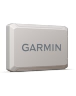
 Garmin Protective Cover for ECHOMAP UHD2 75cv£16.16 £13.47
 -
 Airmar P79 Locking Ring£22.88 £19.07
 -
 BEP Toggle Switch ON.Off-On MOM 20A£23.08 £19.23
 -
 C-Map® Florida and The Bahamas-4D£273.66 £228.05
 -
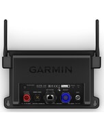
 Garmin OnDeck Hub£675.95 £563.29
 -
 Osculati Encased Automatic Float Switch for Bilge Pumps£25.00 £20.83
 -
 Quick KAI XP LP 4W Recessed LED Downlight - Warm White£82.01 £68.34
 -
 Garmin Reactor 40 2 Liter Autopilot pump kit£763.96 £636.63
 -
 Bluefin LED Bronze Piranha P12 SM Light - Cobalt Blue£451.20 £376.00
 -
 Furuno Netgear GS108 Switch£67.60 £56.33
 -
 NASA 20 Metre Wind MHU Extension cable bare v2£34.47 £28.72


