Garmin BlueChart G3 Update Card - UK & Ireland Marine Detail Map
Estimated Delivery 7 - 14 days
RRP £130.00
This preprogrammed update card for your chartplotter gives you detailed electronic nautical charts that provide a smooth data transition between zoom levels. Data includes navaids, port plans, depth contours, fishing contours, spot soundings and more. Sharp, colorful graphics let you see every cartographic contour and feature, with a minimum of panning and zooming to bring the chart data into focus.
- Provides basic chart navigation with 2-D or 3-D Over the Bow View map perspective.
- Includes tides currents marine points of interest (POIs) and IALA symbols.
- Displays port plans fishing contours and standardized depth contours.
- Supplied on a microSD Card
- Compatible with Garmin EchoMap & GPSMAP Chartplotters
This preprogrammed update card for your chartplotter gives you detailed electronic nautical charts that provide a smooth data transition between zoom levels. Data includes navaids port plans depth contours fishing contours spot soundings and more. Sharp colorful graphics let you see every cartographic contour and feature with a minimum of panning and zooming to bring the chart data into focus.
This package contains map data and a software update for your device. You must perform the software update on your device before this map will work. The card must remain in the device to view updated maps.
Requirements
To update maps using this update card:
- Press the Power key to turn on the device. Do not turn off the device during the update process.
- After the Home screen appears insert the card into the device. The Data Card screen appears.
- If software does not support reading the built-in map update from the card the following message will appear: "Map Format Is Not Supported."
- Acknowledge this message.
- Select "Update Software" to update the device's software. The update process takes approximately 30 minutes to complete.
The device will now recognize the new map format.
Coverage
Detailed coverage of the British Isles in their entirety including the Thames Estuary Caledonian Canal Outer Hebrides Shetland and Orkney Islands Isle of Wight Isle of Man and the Irish Sea. Coverage across the English Channel from Douarnenez France to Emden Germany including the Channel Islands and the Seine River to Rouen France. Detailed coverage includes Antwerp Rotterdam Amsterdam and the Ijsselmeer (Netherlands) in full.
-
-
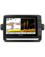
 Garmin ECHOMAP UHD 65cv£490.00 £408.33
 -
-
 BEP Analog DC VoltMeter Panel Mount Up To 3 Inputs 8-16V DC£205.18 £170.98
 -
-
 C-Map® South-East Africa-4D£319.05 £265.87
 -
CZone Cable Assembly Sci 4M Including Rj45 Carling£39.44 £32.87
-
-
 Garmin Navionics Vision+ Chart: EU016R - Mediterranean Sea Southeast
MPN: 010-C1241-00£211.08 £175.90 -