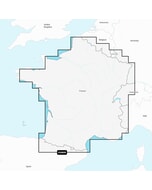
Navionics+ Chart: 3XG - Caribbean & South America - SD-Card
Free mainland UK delivery!
Navionics+ provides complete inshore to offshore marine content, plus rivers, bays, and more than 40,000 lakes around the world. No download required, get the latest chart version supplied on a SD-Card (Micro SD With SD-Card Adapter).
Navionics+ Chart: 3XG - Caribbean & South America - SD-Card
Click here to view all available Navionics+ charts in this range
Navionics+ Features
- Nautical Chart
- SonarChart
- Community Edits
- Daily Updates
- Dock to Dock Autorouting
- SonarChart Live
- Advanced Map Options
- Plotter Sync
Navionics+ provides complete inshore to offshore marine content, plus rivers, bays, and more than 40,000 lakes around the world.
The Navionics subscription
A one-year subscription to Daily Updates and advanced features is included when you purchase any new product.
After a year, you can renew at a discounted price.
Charts & Updates
Nautical Chart - comprehensive charts derived from multiple official, government and private sources, displayed in a familiar look and feel
SonarChart™ - innovative 1' (0.5 m) bathymetry charts created using Navionics proprietary systems
Community Edits - useful local knowledge from edits made by users of the Navionics Boating app
Daily Updates - Up to 5,000 updates to our charts every day.
Subscription Advanced features
Dock-to-dock Autourouting - start your trip with a suggested route
Advanced Map Options - customize your view
Plotter Sync - plan on mobile, go on plotter!
-
 BEP Analog AC VoltMeter Panel Mount Up To 3 Inputs 0-300V AC£203.63 £169.69
 -
-

-
-
-

-
 C-Map® Discover - Malmoe - Valdermarsvik£134.38 £111.98
 -
 Kicker Marine 16AWG Speaker & RGB Wire - 150ft£415.52 £346.27
 -
-
-
 Navico WS320 Wireless Wind Pack. Includes Interface£671.05 £559.21