Navionics+ Large Chart: AE010L - Indian Ocean & South China Sea
Estimated Delivery 7 - 14 days
Free mainland UK delivery!
Navionics Charts are derived from multiple official, government and private sources, displayed in a familiar look and feel. Supplied on a SD-Card (Micro SD With SD-Card Adapter).
This chart replaces the following legacy areas:
- 31XG - Indian Ocean & South China Sea

- Advanced Map Options
- SonarChart Live
- Dock to Dock Autorouting
- SonarChart
- Community Edits
- Nautical Chart
Navionics provides comprehensive charts derived from multiple official, government and private sources, displayed in a familiar look and feel.
The Navionics subscription: A one-year subscription to Daily Updates and advanced features is included when you purchase any new product.
After a year, you can renew at a discounted price.
Charts & Updates
Nautical Chart: Comprehensive charts derived from multiple official, government and private sources, displayed in a familiar look and feel.
SonarChart: Innovative 1' (0.5 m) bathymetry charts created using Navionics proprietary systems.
Community Edits: Useful local knowledge from edits made by users of the Navionics Boating app.
Daily Updates: Up to 5,000 updates to our charts every day.
Subscription Advanced features
Dock-to-dock Autourouting: Start your trip with a suggested route
Advanced Map Options: Customise your view.
Plotter Sync: Plan on mobile, go on plotter!
-
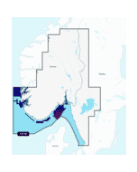
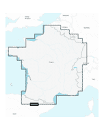 Navionics+ Regular Chart: EU080R - France, Lakes & Rivers£141.54 £117.95
 -
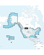
 Navionics+ Regular Chart: US007R - US East£159.92 £133.27
 -
 Navionics+ Regular Chart: AE019R - Taiwan£264.98 £220.82
 -
 Garmin Navionics+ Chart: US001L - U.S. & Coastal Canada£163.22 £136.02