Navionics+ Regular Chart: AE024R - Central W. Papua & E. Sulawesi
RRP £139.99
Navionics Charts are derived from multiple official, government and private sources, displayed in a familiar look and feel. Supplied on a SD-Card (Micro SD With SD-Card Adapter).
- Advanced Map Options
- SonarChart Live
- Dock to Dock Autorouting
- SonarChart
- Community Edits
- Nautical Chart
Navionics provides comprehensive charts derived from multiple official, government and private sources, displayed in a familiar look and feel.
The Navionics subscription: A one-year subscription to Daily Updates and advanced features is included when you purchase any new product.
After a year, you can renew at a discounted price.
Charts & Updates
Nautical Chart: Comprehensive charts derived from multiple official, government and private sources, displayed in a familiar look and feel.
SonarChart: Innovative 1' (0.5 m) bathymetry charts created using Navionics proprietary systems.
Community Edits: Useful local knowledge from edits made by users of the Navionics Boating app.
Daily Updates: Up to 5,000 updates to our charts every day.
Subscription Advanced features
Dock-to-dock Autourouting: Start your trip with a suggested route
Advanced Map Options: Customise your view.
Plotter Sync: Plan on mobile, go on plotter!
-
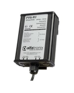
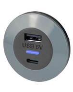 Alfatronix PVPro-ACFF USB A & C Charger - Front Fit£27.84 £23.20
 -
 Maretron BHW100 Bilge High Water Detector£60.00 £50.00
 -
 Rebelcell Outdoorbox 12.35 AV - 12V 35A 432Wh£559.00 £465.83
 -
 BEP Current Transformer AC Digital Meter£28.89 £24.07
 -
 Garmin Flush Mount Kit for GPSMAP 840£19.96 £16.63
 -
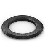
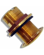 Raymarine Bronze Fitting for Long Body Transducers£158.12 £131.77
 -
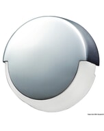 Osculati Adara Ambient LED Downlight - White£17.15 £14.29
 -
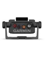 Garmin Bail Mount With Quick Release Cradle For Echomap UHD2 6sv£120.53 £100.44
 -
 Garmin BlueChart G3 Vision - VEU047R: Gulf of Bothnia£227.55 £189.62
 -
 Garmin Galvanic Isolator Kit£29.99 £24.99